DIGMATE
AI-POWERED GOLD PROSPECTING FIELD COMPANION
The only app that combines AI terrain analysis, GPS mapping, ground scanning, rock identification, and historic mine data — all in your pocket. Built for Australian gold hunters.
NSW + VIC + QLD
COVERAGE
OFFLINE
CAPABLE
AI POWERED
GOLD PHYSICS
PWA
INSTALLS ON PHONE
WHAT DIGMATE ACTUALLY DOES
Open the app, go to your spot, and let the AI tell you exactly where to dig.
Tap Lucky Spot anywhere on the satellite map. The AI analyses the landscape using gold deposition physics — specific gravity, water velocity, bedrock traps — and pinpoints where gold is most likely sitting right now.
You get a gold star pin for fine alluvial gold (best for panning) and an orange diamond pin for the highest-probability nugget location. Each pin comes with geological reasons and a confidence score.
Tap the nugget pin and get a tailored detector guide — recommended search pattern (grid, spiral, or parallel strips), coil size, expected target depth, and ground conditions. No guesswork.
SEE IT IN ACTION
Real screenshots from the app — no mockups, no stock photos.
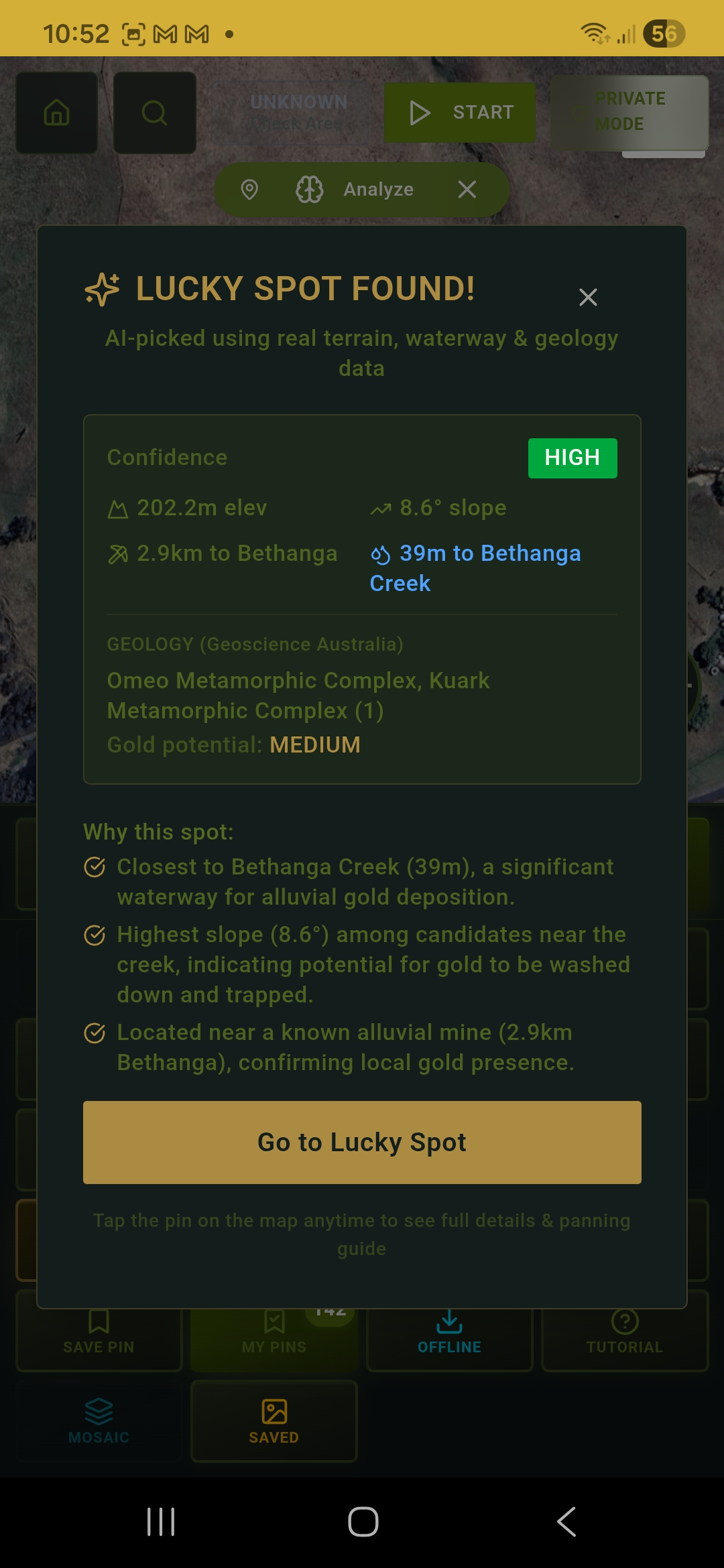
Lucky Spot — HIGH confidence
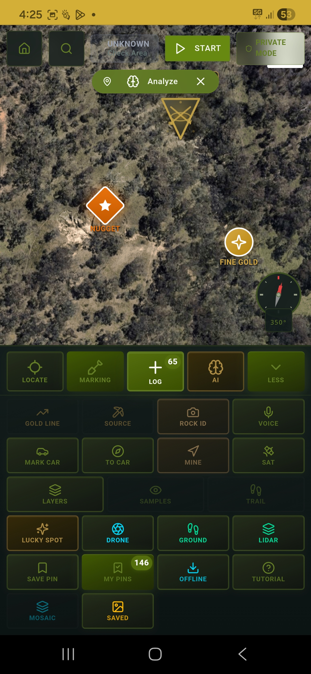
Nugget & Fine Gold pins on satellite
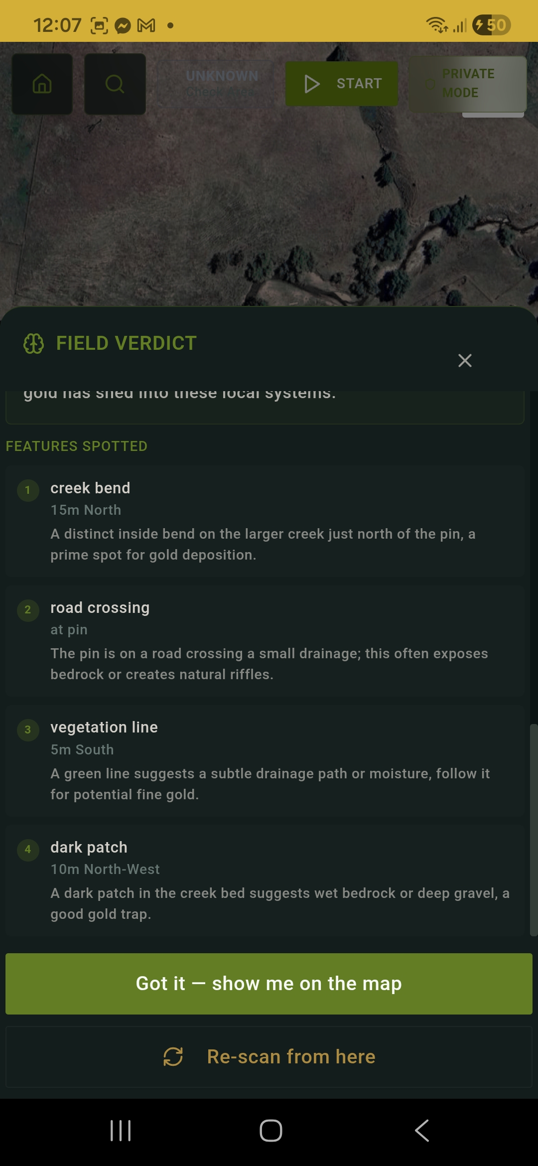
Field Verdict — creek bend analysis
Full tool suite
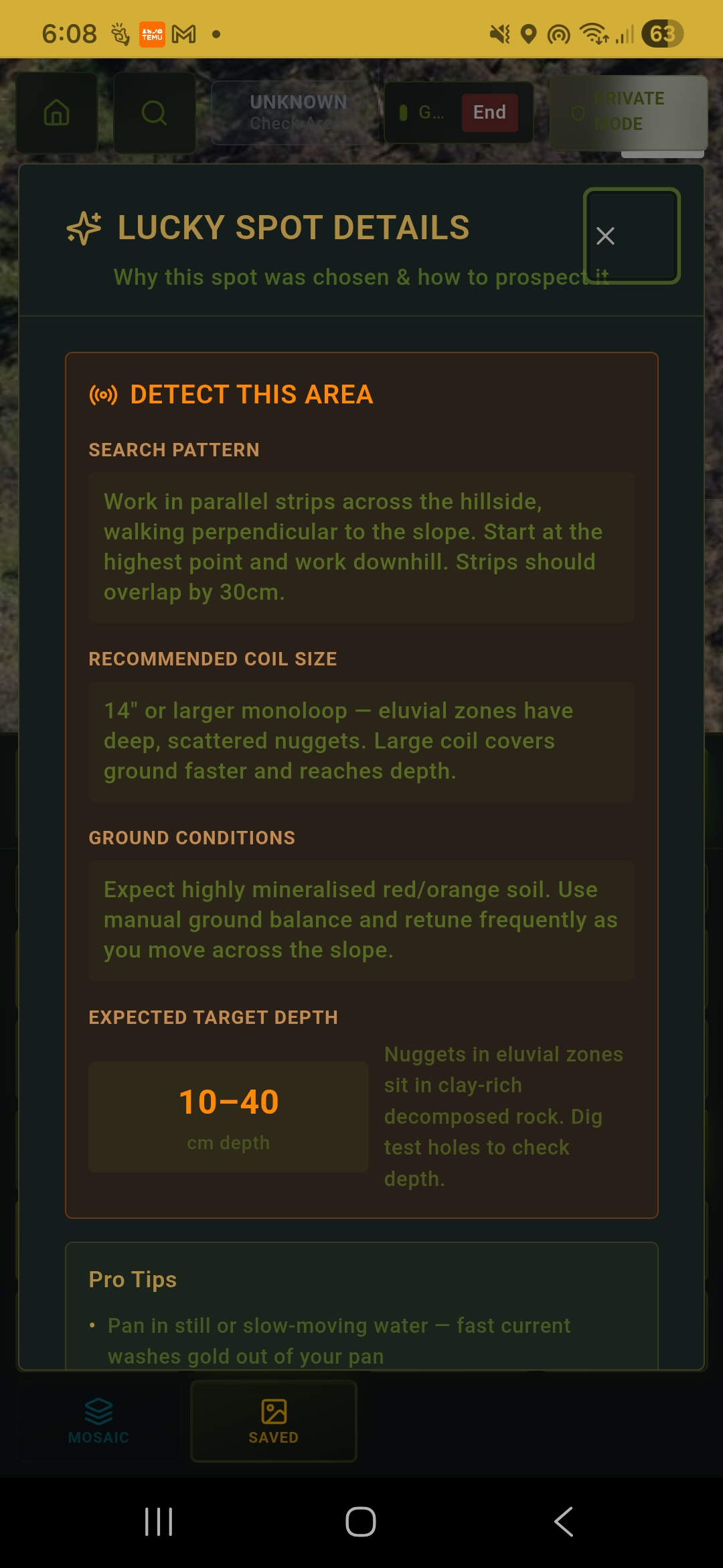
Detect This Area — search pattern & coil guide
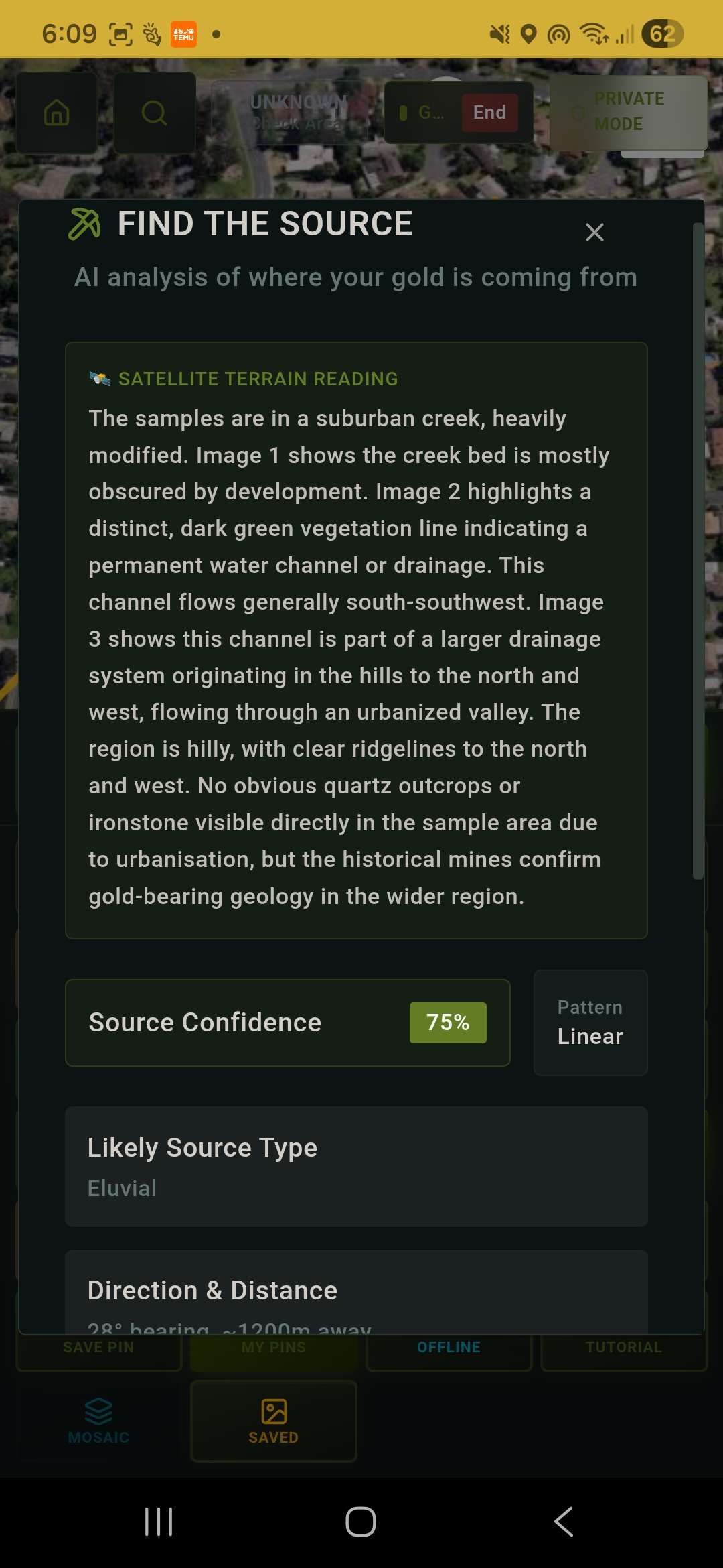
Find The Source — AI traces gold origin
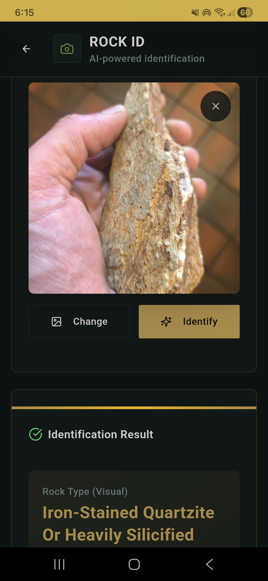
Rock ID — AI identifies gold indicator rocks
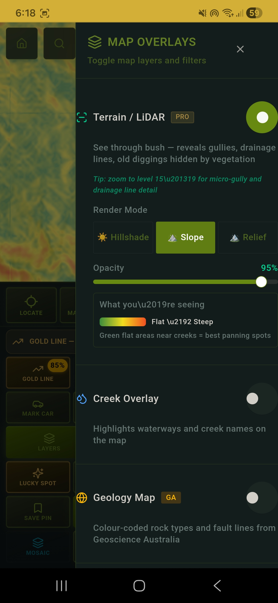
LiDAR Slope — reveals best panning spots
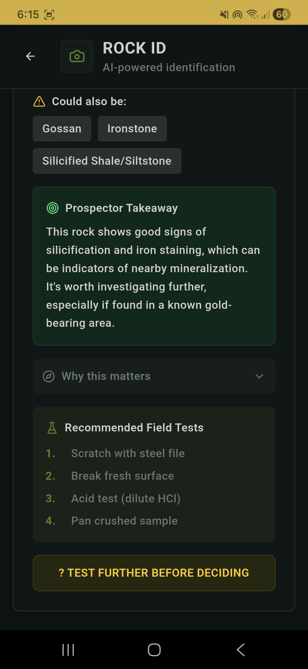
Rock ID — Prospector Takeaway & field tests
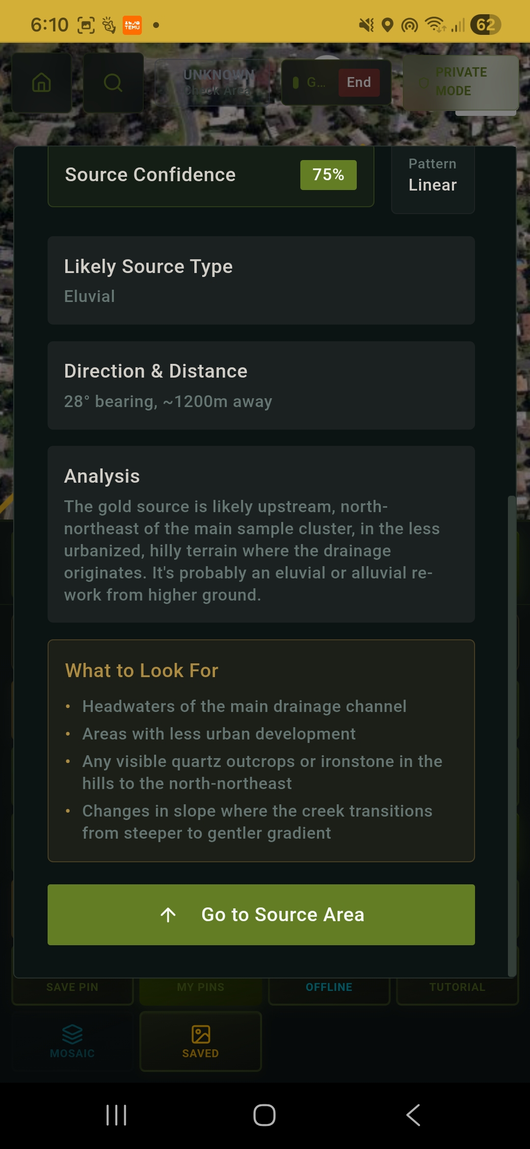
Find The Source — direction, distance & what to look for
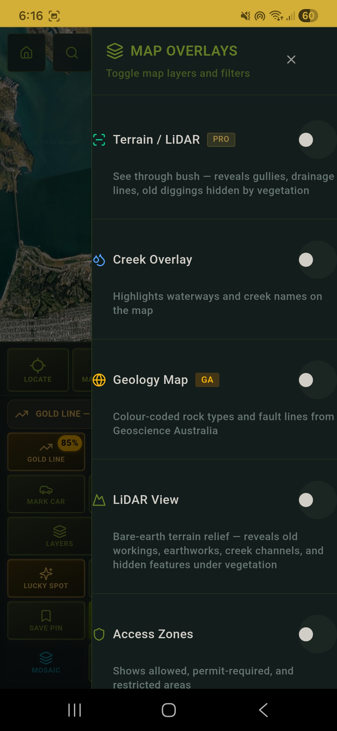
Map Overlays — LiDAR, Geology, Creek & Access layers
LUCKY SPOT
The AI has been trained with expert-level gold prospecting knowledge. It understands how gold moves — specific gravity 19.3 means it sinks at the first velocity drop. It reads satellite imagery for bedrock colours, quartz vein indicators, iron staining, and erosion patterns.
Fine Gold Pin
Inside bends, creek junctions, gravel bars — where alluvial gold settles
Nugget Pin
Eluvial, supergene, or alluvial trap — classified by formation type
Detect Guide
Search pattern, coil size, depth, and ground tips for each nugget type
NUGGET TYPES THE AI IDENTIFIES
ELUVIAL
Nuggets weathered from a reef, still on the hillside close to source. Walk the slope above the creek.
SUPERGENE
Gold re-deposited in bedrock cracks by groundwater. Tight grid search, small coil, work the exposed rock.
ALLUVIAL TRAP
Heavy nuggets dropped at the first velocity reduction below a reef. Spiral search from the bend outward.
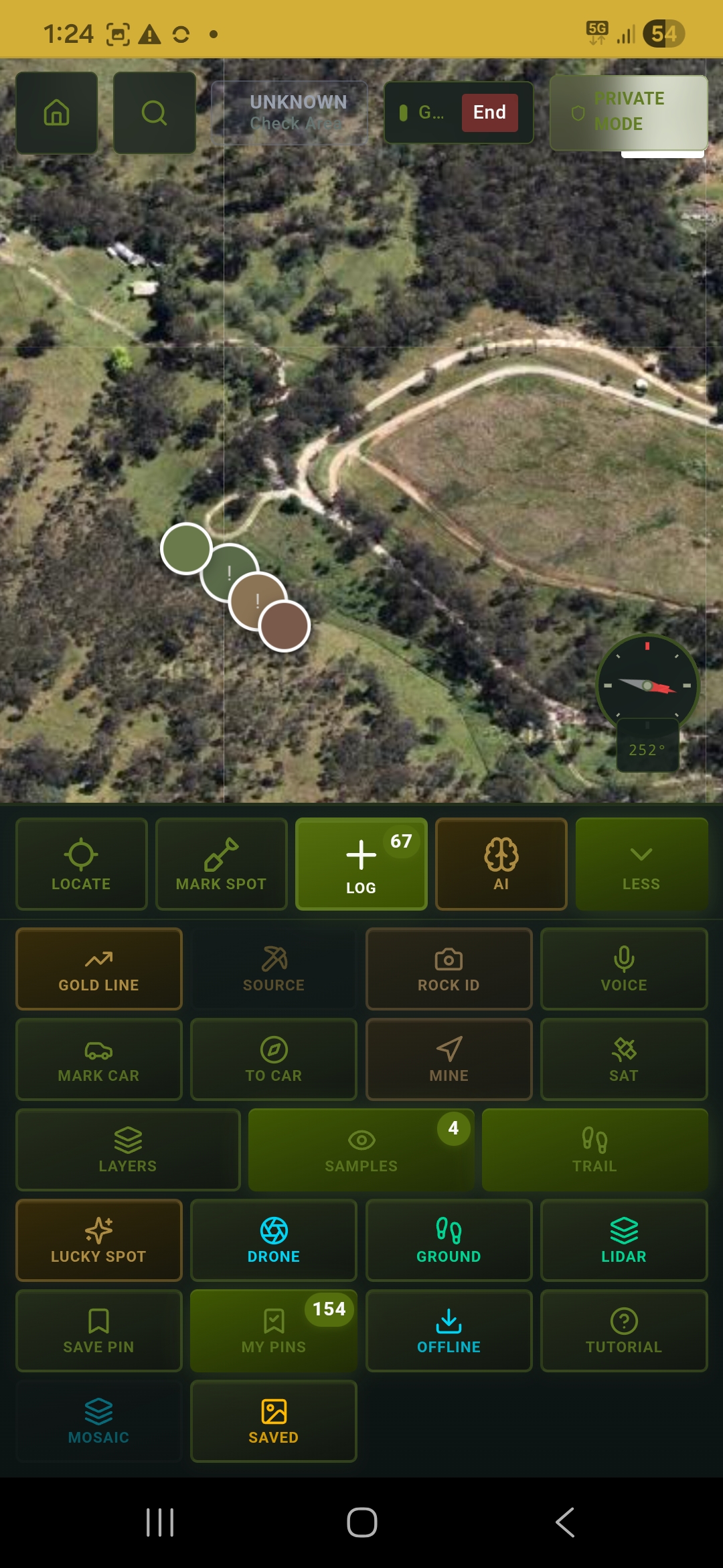
HOW GROUND SCAN WORKS
Tap Record and walk your grid
Camera records video continuously — no tapping
Frame extracted automatically every 1.5m of GPS movement
9×9 survey grid on map turns green as you cover cells
Tap Stitch — AI assembles a georeferenced mosaic
Mosaic overlays on the map at exact GPS coordinates
Download as PNG, share, or upload to cloud
GROUND SCAN
Walk your grid and DigMate automatically builds a bird's-eye photo mosaic of the ground surface. See bedrock structure, colour changes, and surface patterns that are invisible when you're looking straight down.
The GPS-anchored walking grid on the map shows exactly which cells you've covered in real time — no more overlapping or missing strips.
EVERYTHING IN THE APP
Every tool you need from the car park to the creek bed.
INSTALL ON YOUR PHONE
No app store. No download. Just open and install.
ANDROID
Open Chrome on your Android phone
Go to digmateapp-fwzfy7t8.manus.space
Tap the 3-dot menu (top right)
Tap "Add to Home Screen"
Tap Install — done
iPHONE / iPAD
Open Safari on your iPhone
Go to digmateapp-fwzfy7t8.manus.space
Tap the Share button (box with arrow)
Scroll down and tap "Add to Home Screen"
Tap Add — done
PLANS & PRICING
Start free. Upgrade when you're ready to go deep.
$0
$9.99/mo
$19.99/mo
$50 one-time
BUILT ON REAL GEOLOGICAL DATA
DigMate pulls from government geological surveys, satellite imagery, and historic mine records — the same data professional exploration companies use.
HISTORIC MINE RECORDS
Thousands of historic mine locations from NSW, VIC, and QLD government databases. Tap any mine for name, era, type, and what was found there.
ANCIENT WATERWAYS
1,385 Victorian Deep Lead channel lines from the Geological Survey of Victoria. These buried paleochannels are where alluvial gold concentrates over millions of years.
CONVERGENCE ZONES
AI cross-references geology, mines, waterways, terrain, and Sentinel-2 satellite vegetation data to flag spots where 3+ gold signals overlap — the same multi-element approach used by exploration geologists.
GOLD TARGETS OVERLAY
23,250 real gold occurrences mapped from the Victorian and NSW Geological Surveys. Toggle between shallow alluvial (shovel-diggable), deep buried leads, and hard rock reef targets. Every dot is a recorded government survey point — not a guess.
Your data stays yours. DigMate does not share your finds, locations, or trip data with anyone. Private Mode hides your GPS position entirely.
READY TO FIND GOLD?
Join Australian prospectors using AI to work smarter in the field.
No app store required · Works on any phone · Install in 30 seconds